 By
By 
Jokulsargljufur National Park is one of Iceland’s oldest national parks, established in 1973. But this national park went a similar route as one of our other famous national parks here on the island, Skaftafell National Park, which was incorporated into Vatnajökull National Park, now Iceland’s largest national park.
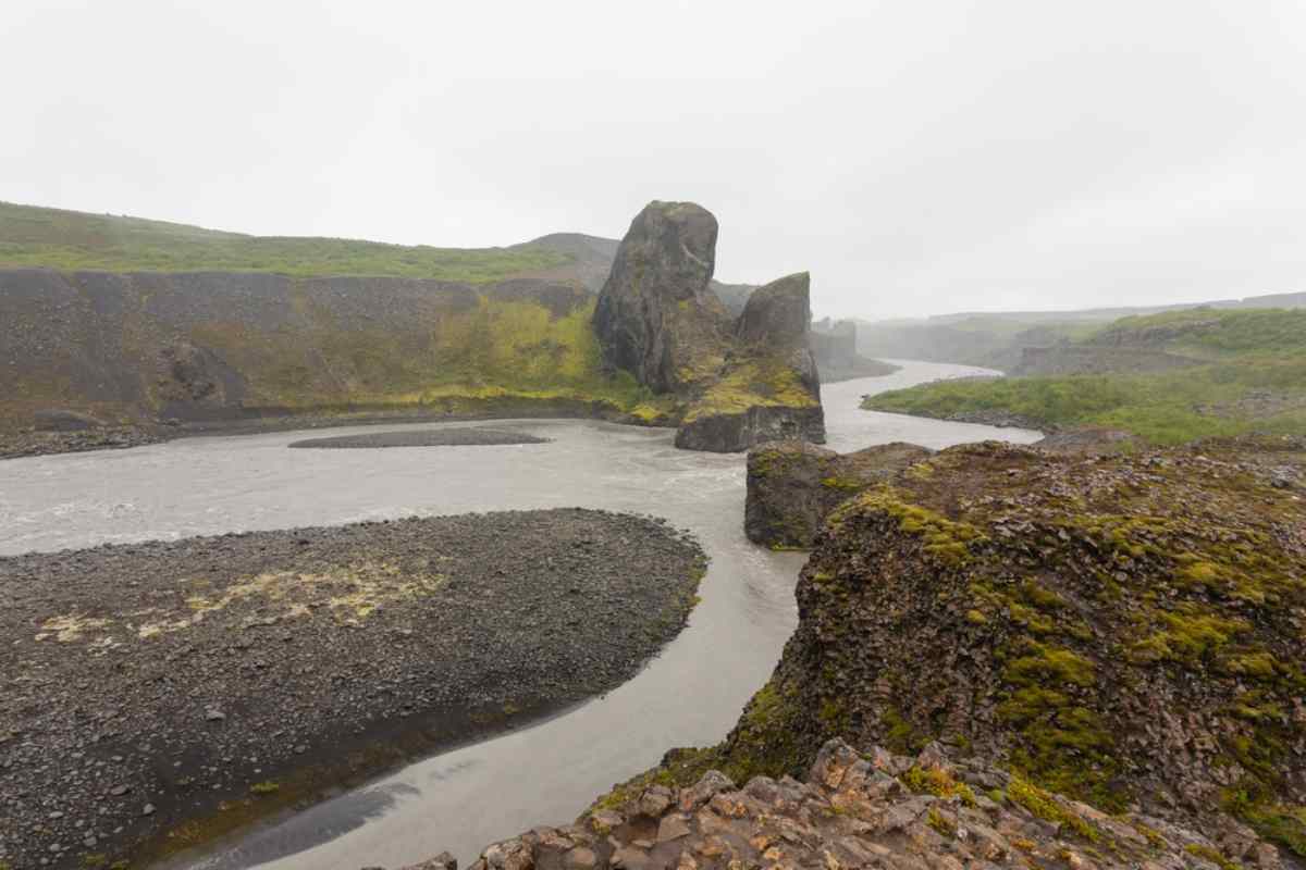
The park stretches over 150 square kilometers, and its biggest claim to fame is its breathtaking canyons, one of which, Jokulsargljufur, is actually where the park’s name comes from. Jokulsargljufur National Park holds some of Iceland’s most impressive natural wonders and is an absolute must-visit for anyone who loves outdoor adventures.
Geological Formation: How Jokulsargljufur National Park Came to Be
Like so many impressive landscapes here in the Land of Fire and Ice, Jokulsargljufur National Park is the result of the clash between these two elements. Massive volcanic eruptions are believed to have occurred 10,000 years ago and then again 3000 years ago, causing glacial floods.
These floods carved their way through the earth, creating the incredible canyons, ravines, and rock formations you see at Jokulsargljufur National Park today. The aftermath of the glacial flood is also seen in the Jokulsa a Fjollum (a glacial river) that still flows through the park.

Key Attractions at Jokulsargljufur National Park
As we already mentioned, Jokulsargljufur National Park has many of Iceland’s most famous attractions. These include the following:
Jokulsargljufur Canyon
Jokulsargljufur Canyon translates to “glacier river canyon,” which is pretty descriptive of its origins. The canyon is more than 24 kilometers long, 0.5 kilometers wide, and 100 meters deep. Today, the canyon is home to many other natural wonders and outdoor activities such as hiking and birding.

Dettifoss Waterfall
Dettifoss is one of the must-visit waterfalls in Iceland. It officially holds the title as the second most powerful waterfall in Europe, with a staggering 3,059,436 gallons or 11,581,225 liters of water rushing over its cliffs every minute! This is one of those waterfalls that creates so much mist and spray that you are bound to get drenched without a raincoat or waterproof clothing, especially on windy days. The waterfall is a further impressive 100 meters wide and 44 meters high.

Selfoss Waterfall
Selfoss can be found just upstream from Dettifoss and has nothing to do with the town that goes by the same name. Selfoss might not be one of our tallest waterfalls here in Iceland, clocking in at just 11 meters, but it certainly is one of the widest, measuring in at 100 meters, just like Dettifoss.

Hafragilsfoss Waterfall
Hafragilsfoss is yet another waterfall found upstream from Dettifoss. It is known as one of the largest waterfalls in Iceland, measuring 91 meters wide and 27 meters tall. Hafragilsfoss Waterfall can be viewed from both sides of the river.

Hjodaklettar (aka Echo Rocks)
Hjodaklettar, also known as Echo Rocks, can be found about 15 kilometers south of Asbyrgi Canyon. Hjodaklettar is a cluster of three rock formations:
- Kastali (“The Castle”) – this rock formation consists of two main pillars that give it a fortress or castle-like appearance.
- Tröllid (“The Troll”) – some say this rock formation looks like a guard watching over the castle, but the name itself should give you a clue as to the mythology surrounding this rock. Trolls, according to old Norse beliefs, turn into stone when they get caught in sunlight.
- Kirkjan (“The Church”) – here, you will find a symmetrical arch that’s also the entrance to a cave where you will find out why Hjodaklettar is also known as the Echo Rocks. Give a shout or sing a song in this cave, and you’ll be met with strange echos and acoustics.

Asbyrgi Canyon
Asbyrgi Canyonforms part of the larger Jokulsargljufur Canyon and is shaped like a horse-shoe. It is about 3.5 kilometers long and 1 kilometer wide and is the setting for yet another famous legend here at Jokulsargljufur National Park. It is said that Asbyrgi is the imprint made by Odin’s eight-legged horse as they were galloping across the earth. It is also believed that the Asbyrgi cliffs are home to our Hidden Folk.

The Wildlife at Jokulsargljufur National Park
As can be expected, Jokulsargljufur National Park is home to a variety of wildlife. From reindeer and our elusive predator, the Arctic Fox to birds that will get any avid birder excited such as the Gyrfalcon, Rock Ptarmigan, and Eurasian Golden Plover. The canyon and its woodlands are filled with vegetation and flowers in the warmer months and bright green moss covers the canyon’s cliffs.
Hiking Trails in Jokulsargljufur National Park
With canyons stretching out for kilometers and incredible natural wonders around every corner, it’s no surprise that Jokulsargljufur National Park is a go-to spot for hikers. There are numerous trails in Jokulsargljufur with various difficulty levels. You will know what these difficulty levels are based on the color code the trail is marked with.
Red routes are difficult and very long and should only be taken on by experienced and fit hikers. Orange routes are considered challenging and are longish trails, but doable for anyone who’s in good physical shape. The green routes tend to be the shorter trails and easy enough for anyone to complete. Some of the most popular trails in Jokulsargljufur National Park are:
Botnstjörn Pond, Asbyrgi
- Difficulty Level: Moderate
- Distance: 1.3 kilometers
- Duration: +/- 30 minutes
This loop trail offers spectacular views of the pond and Asbyrgi Canyon. The trail is ideal for birders or those who just want a short hike to enjoy some solitude.

Raudholar Circle
- Difficulty Level: Moderate
- Distance: 5.1 kilometers
- Duration: +/- 1 hour, 30 minutes
This loop trail is perfect for those who just want to immerse themselves in the beauty and nature of Jokulsargljufur. You’re also bound to spot a few interesting bird species along this route.
Hljodaklettar Circle
- Difficulty Level: Easy
- Distance: 2.7 kilometers
- Duration: +/- 45 minutes
This loop trail will take you to Hiljodaklettar. Some with children or older people in their party, shorten the route by about a kilometer simply by turning back at Tröllid, the first rock formation.
Eyjan Hill Trail
- Difficulty Level: Easy
- Distance: 4.8 kilometers
- Duration: +/- 1 hour, 15 minutes
This out-and-back trail is mostly flat, with incredible views over the landscape. Eyjan Hill also puts you in the middle of Asbyrgi Canyon. This route is famous for being family-friendly and doesn’t have as much traffic as other trails here on the island.

Through the Woods Trail
- Difficulty Level: Moderate
- Distance: 8.3 kilometers
- Duration: +/- 2 hours
This out-and-back trail starts at the Visitor Centre and runs all along the eastern wall of the canyon to the Botnstjörn Pond. This route goes through various forests where one is guaranteed a few interesting bird sightings.
Svinadalur Circle
- Difficulty Level: Moderate
- Distance: 7.1 kilometers
- Duration: +/- 1 hour, 40 minutes
This loop trail also allows you to simply take in the serenity and beauty of Jokulsargljufur. You can expect quite spectacular views over the rock formations and the river.
Vesturdalur to Botnstjörn Pond
- Difficulty Level: Difficult
- Distance: 18.3 kilometers
- Duration: +/- 4 hours, 30 minutes
This out-and-back trail to Botnstjörn Pond is reserved for only the experienced and fit hikers among us. Needless to say, although this trail can get pretty tough, it’s also very rewarding.

Eyjan Hill
- Difficulty Level: Moderate
- Distance: 1.9 kilometers
- Duration: +/- 35 minutes
This is a loop trail that will also get you to Eyjan Hill. The only difference is that this one is a little harder than the first, but still not difficult. So, if you’re just looking for a bit more of a challenging route than the first Eyjan trail, this is it.
Planning Your Visit to Jokulsargljufur National Park
Are you getting excited to visit the incredible Jokulsargljufur National Park yet? In the following section, we have compiled everything you need to know to plan the perfect visit to Jokulsargljufur National Park.
Where is Jokulsargljufur National Park?
Jokulsargljufur is found in northern Iceland on the northernmost tip of the Vatnajökull National Park. The nearest city is Husavik, which is roughly 60 kilometers away. The other big city near Jokulsargljufur is Akureyri (the so-called capital city of the north), which is about 130 kilometers away.
So, if you want to do a day trip to Jokulsargljufur National Park, it’s recommended that you do it from one of these cities. But many prefer to have the park as a stop along their Diamond Circle road trip, exploring the rest of northern Iceland and all its highlights.
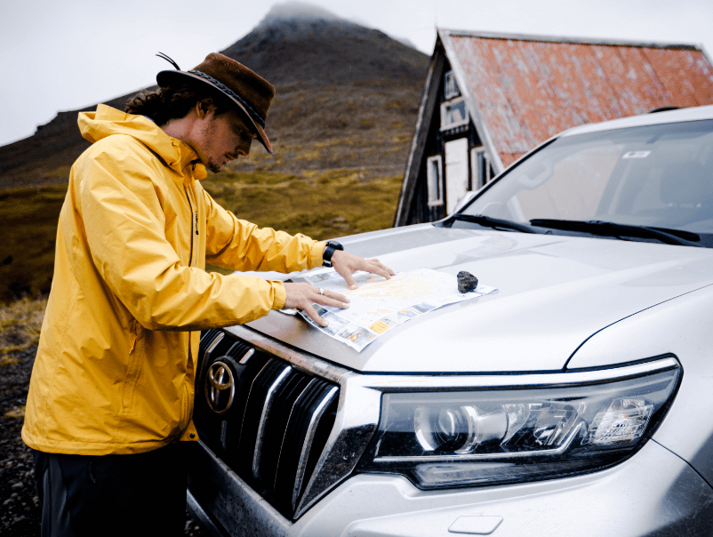
How to Get to Jokulsargljufur National Park
There used to be a bus service that ran between Akureyri and the Visitor Center, but, unfortunately, this service has been suspended. Now, the only way to reach Jokulsargljufur is via guided tour or driving yourself. The guided tours mostly depart from the bigger cities here on the island and range from day tours to multi-day holiday tours.
There’s also the option of arranging a customized private tour with one of our local tour operators or guides. If you are planning on driving yourself, whether as a day trip or a Diamond Circle road trip, there are only two ways you can get there:
From Husavik
- This drive will take you about 50 minutes.
- Start driving southwest to Gardarsbraut.
- Turn right at Gardarsbraut and continue onto Hedinsbraut.
- Continue onto Route 85 until turning right at Asbyrgi.
- Simply follow the signs to the Visitor’s Center.
From Akureyri
- This drive will take you about 1 hour, 45 minutes.
- Take Skipagata to Drottningarbraut.
- Continue onto Podvegur, Nordausturvegur, and Route 85.
- Continue with Route 85 till you reach Asbyrgi.
- Follow the signs to the Visitor’s Center.
The Best Time to Visit Jokulsargljufur National Park
Technically, you’ll be able to visit Jokulsargljufur National Park all throughout the year, but there are a few things to consider when planning your trip:
- Since Jokulsargljufur is a place for outdoor adventures, most prefer going during warmer months of the year, especially the summertime. Not only do these months boast warm temperatures and milder weather conditions, but they also have ample daylight hours for your jam-packed trip itinerary.
- Summertime in Iceland is considered peak season. This means peak season crowds and a much busier Jokulsargljufur National Park.
- Many, especially photographers, say winter brings a different charm to the area. Thick blankets of snow draped over the landscape, waterfalls with frozen tentacles dangling over the cliffs, and many more winter wonderland attributes make this the preferred season for some. But road conditions can become tricky to navigate, especially in the north, and sudden road closures can derail your plans.
Operating Hours at Jokulsargljufur National Park
While the park is open all year round, the campsites and visitor centers are a different story. Many are only open during our warmer weather months, from May/June to September. There can also be changes in office hours between the seasons, varying from 06:00 to 19:00 and 11:00 to 15:00.
So, please double-check with Jokulsargljufur National Park before compiling your trip itinerary or heading out for the day. Since the weather and road conditions can also impact accessibility to Jokulsargljufur, we highly recommend that you keep a close eye on the Iceland weather forecast as well as the Iceland road conditions.
How Much are Jokulsargljufur National Park Tickets?
From June 2023, the park has introduced a regional fee that looks as follows:
- Category A – Passenger Car, up to 5 seats = 1000 ISK ($7.20 or €6.70)
- Category B – Passenger Car, between 6 to 9 seats = 1300 ISK ($9.35 or €8.70)
- Category C – Bus, between 10 to 19 seats = 2500 ISK ($17.95 or €16.75)
- Category D – Bus, between 20 to 32 seats = 4700 ISK ($34.00 or €31.45)
- Category E – Bus, 33+ seats = 8500 ISK ($61.00 or €56.85)
- Motorcycle = 400 ISK ($2.90 or €2.70)
Jokulsargljufur National Park: A Hidden Gem Along the Diamond Circle Route
Since most have only heard of our big national park, Vatnajökull, many are surprised to learn about Jokulsargljufur and how many famous Icelandic landmarks and natural wonders can be found there, truly making Jokulsargljufur National Park a hidden gem along the Diamond Circle route.
Whether you’re a nature lover, an adventure seeker, or simply looking for a peaceful escape, Jokulsargljufur has something to offer. From hiking and camping to bird watching and photography, there are plenty of ways to explore this stunning destination. If you rent a campervan in Iceland to do your road trip with, you can even camp in comfort at the Asbyrgi campsite, which will get you closest to the action.
So, pack your bags, grab your camera, and hit the road so you, too, can experience the beauty of Iceland’s Jokulsargljufur National Park!