 By
By 
Sigur Rós are one of the most successful bands in Icelandic history. Their unique style makes their music instantly recognizable, featuring a bow guitar and an invented language among other sounds.
If you’ve been to Iceland, you can also see the link between the band’s artistic output and their environment: it’s abundantly clear that the country’s landscape inspires their music.
In 2016, Sigur Rós showcased this connection with a production that seamlessly combined their music with Icelandic travel.
The band drove the entirety of Route One, or the Ring Road, which circles the country, in 24 hours. With just a dashboard camera, they recorded their journey and streamed it on YouTube with accompanying music. The result was so captivating, they ended up created a new whole Iceland itinerary trend.
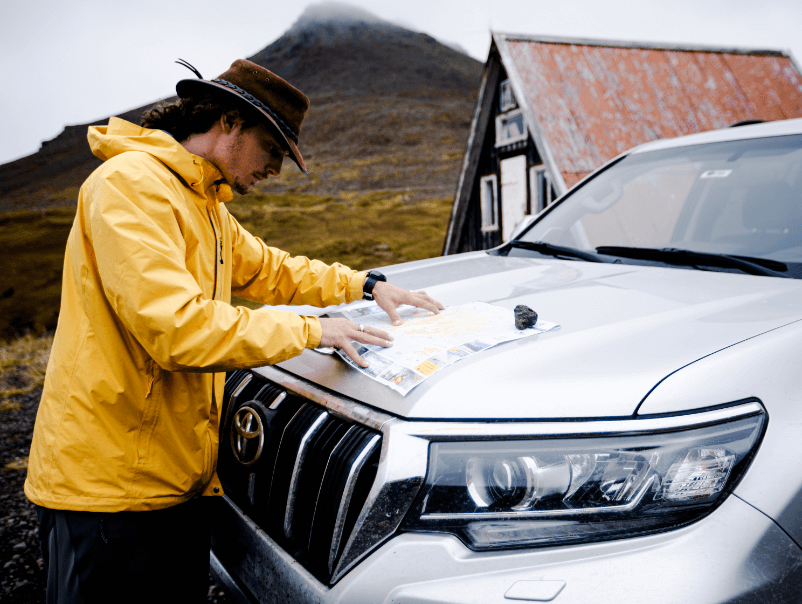
Let’s take a closer look at the Sigur Rós Route One music and the memorable trip behind it. This will get you excited to have your own Ring Road adventure; book your camper for the journey. But first, who exactly are Sigur Rós?
Sigur Rós: The Band
Perhaps best defined as a member of the post-rock genre, Sigur Rós have been making music since 1994.
Although their line-up has changed since the band’s creation, Jón Þór "Jónsi" Birgisson has remained on bow-guitar and vocals. Georg Holm has also always been present on bass and back-up vocals. Kjartan Sveinsson, keyboardist, has returned after several years away.
Over the course of nearly 28 years, the band has released seven studio albums, as well as completing multiple side projects. They have over 90 million views combined on their YouTube channel.
In February 2022, the band announced that it would go on another world tour, their first in five years. They’re also working on a new album.
Many of Sigur Rós’s songs are sung in Icelandic, but they also utilize random vocalizations they call “Vonlenska” (translation: Hopelandic). This is a collection of sounds that fit with the music, and while it bears no structural resemblance to a language, it does sound incredible. Now, onto the Sigur Rós Route One project.

Sigur Rós: The Route One Album
The album is not a collection of eight original songs in the conventional sense. Rather, it’s eight tracks that were auto-generated by music software when fed with the stems from the band’s song ‘óveður’.
At the time, the song was a new release, and the software reinvented the stems constantly to create new music. Thus, the musical output is different during the entire day.
After their journey, the band took this 24-hour long endless flow and split it into eight tracks. They presented this as their Route One album, and the name of each track was published as a set of coordinates.
Why these specific coordinates, you may ask? Well, in some cases, these were places they stopped, presumably to change drivers and/or see the sites.
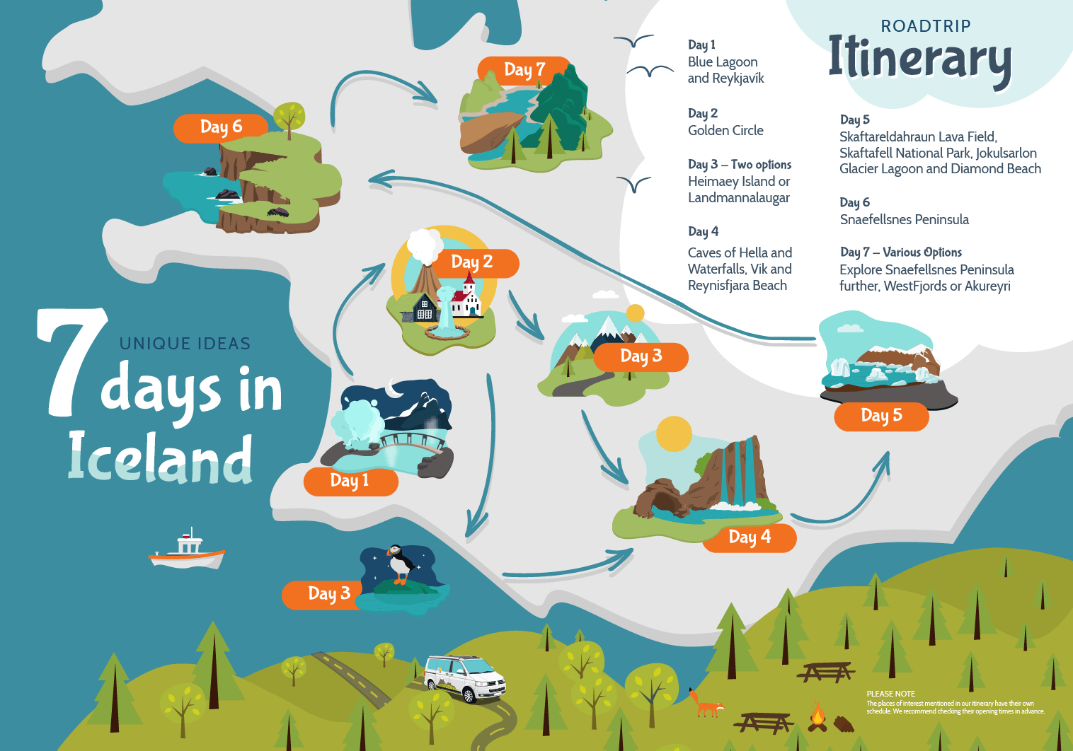
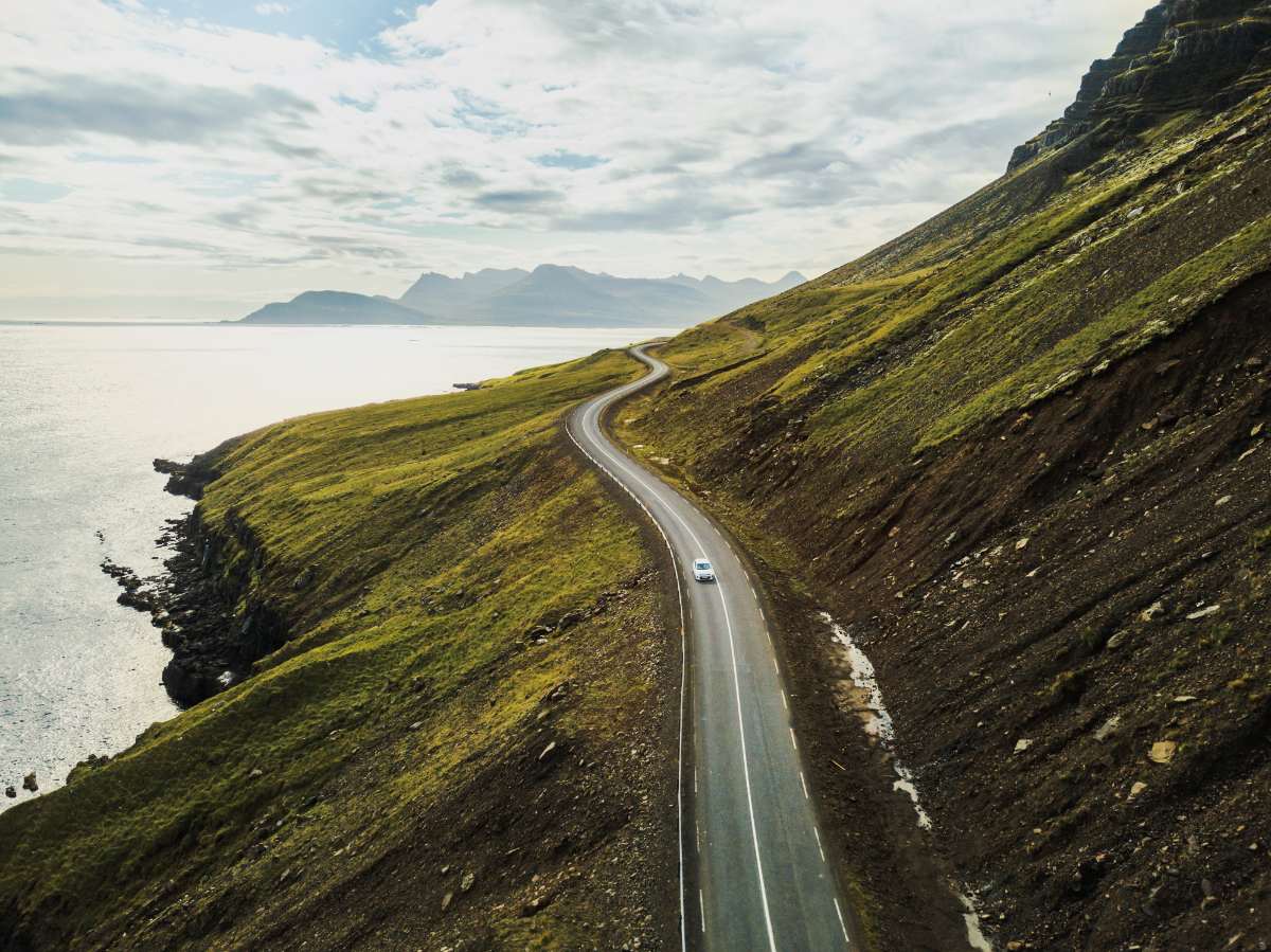
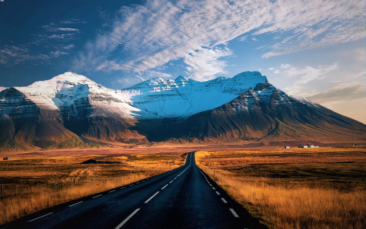
Let’s examine the locations on the Sigur Rós Route One Album. For the benefit of your own trip, we’ll describe what there is to see and do at the chosen coordinates. To follow along, watch part one of the video. The road is 1332 km (828 miles), so that’s why the journey took a whole day.
64°08'43.3"N 21°55'38.8"W – Track 4
For whatever reason, the track order isn’t in the order of the route, but here we go. This coordinate is Reykjavík, specifically the main shopping street in downtown, Laugavegur.
The capital city is full of incredible museums, historical buildings, gift shops and shopping malls. It’s also where the headquarters of most of the country’s businesses are located, as well as the highest concentration of hotels and hostels.
Spending your arrival or departure day here would be a good idea, as there’s tons to do and it’s located conveniently close to the airport you’ll fly into.
63°32'43.7"N 19°43'46.3"W – Track 1
Firstly, since this is along the south coast, we can say that the band traveled counter-clockwise around the Ring Road. However, when you travel yourself, it doesn’t matter which direction you take, so pick based on what activities you want to do first.
This spot is about two hours from Reykjavík, next to the small lake of Holtsós. On a clear day, this would be a great place to find a rest stop and enjoy the view. To the southwest of these coordinates, there is the archipelago of Vestmannaeyjar, or the Westman Islands. Above them is the glacial-topped volcano, Eyjafjallajökull.
If the sky is clear, you’d be able to see both wonders from this location. If you had turned onto Route 254 further back, you’d have reached the harbor that services ferries to Vestmannaeyjar.
The main island, Heimaey, is the only one with human habitants, around 4,500 in total. You can complete some great short hikes here, or even walk around the entire island if you’re feeling energized.

If you were to go a little further past this point, you’d reach the turning for Skógar road. This takes you to Skógafoss, one of the famous waterfalls of Iceland’s south coast.
The site has appeared in both Game of Thrones and the Vikings series. It’s also the beginning, or end, of a famous long hiking trail, Fimmvörðuháls, which takes you between two glaciers.
63°47'36.2"N 18°02'16.9"W – Track 2
These coordinates are centred on the village of Kirkjubæjarklaustur; more specifically, the bridge over a small river. It’s 1 ½ hour east of the first coordinate, and by this point, you’ve passed the town of Vík.
Kirkjubæjarklaustur has a population of 150, a gas station, a supermarket and some tourist accommodations.
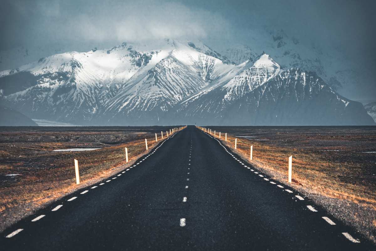
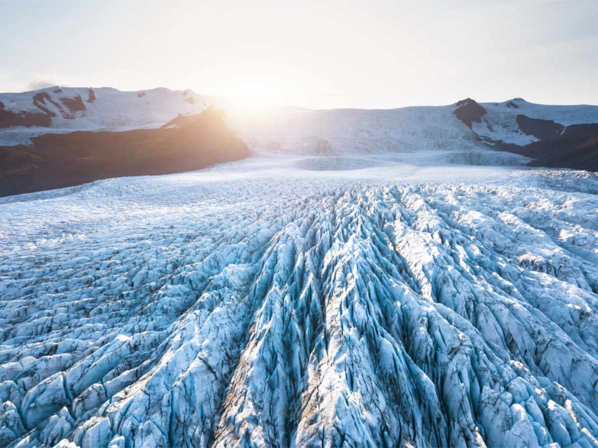
This farming community is fairly close to Vatnajökull, Iceland’s largest glacier, which is part of Vatnajökull National Park. On a clear day, you’ll be able to see the glacier from the village. However, it’s much better to enter the park and see it up close. While you’re here, there are many additional fun activities.
Vatnajökull National Park is full of hiking trails, waterfalls and other natural features. It’s very much worth staying a day or two to explore the area. If you visit in winter, ice caving and glacier hiking are also an option.
Closer than the park, though, is a wonderful natural rock formation right next to Kirkjubæjarklaustur. This is known as Kirkjugólf, a series of hexagonal basalt columns with only the tops showing.
64°02'44.1"N 16°10'48.5"W - Track 3
Another 1 ½ hours along the Ring Road, the next track’s coordinates center on the entrance to Jökulsárlón Glacier Lagoon. This lagoon is formed of meltwater from Vatnajökull glacier, and there are also pieces of glacial ice floating in it. It’s a phenomenal sight just from the shore, but a company takes boat tours into the lagoon.
Choosing either a slow Amphibian boat or a fast Zodiac dingy, you can get up close to the floating ice. If you’re lucky, you may see a few seals relaxing on the broken pieces. Stopping at the lagoon is a must-do on a Ring Road tour.
On the other side of the road, you’ll come across Diamond Beach. This is a black sand beach with pieces of the glacial ice washed up onto it-visually stunning and downright photo-worthy.
64°46'34.1"N 14°02'55.8"W – Track 5
Now you’re on the East Coast, and this coordinate lies on a bridge that crosses a fjord. You’ll find many such bridges and tunnels along Route 1 which shorten the route considerably. All but one of these shortcuts is free; there is a tunnel which charges near to Akureyri in the north.
If you drive a bit further along, you’ll come to Egilsstaðir, the capital of the east. It’s a town near to Iceland’s largest forest, Hallormsstaður, and to what is considered the country’s most beautiful fjord, Seyðisfjörður.
It’s here where some of the best hikes can be conquered, along with jaw-dropping sightings of wildlife in their natural habitat.
65°27'29.1"N 15°31'56.0"W – Track 6
At this point, the Ring Road cuts past a large section of Iceland, the Eastfjords. This area is sparsely populated and very few tourists make it all the way up. Very close to these coordinates, there’s a turning for Route 85.
If you want to explore some of the country’s most isolated communities and avoid the tourist crowds, turn here. Otherwise, continue along the Ring Road and soon you’ll come to a turning onto the Diamond Circle, on Route 864.
The Diamond Circle is a route that is famous for its waterfalls, epic natural features, and a town with incredible whale watching attractions. Note: some parts of the circle are unpaved gravel roads, and may be closed off in bad weather.

65°30'17.9"N 18°37'01.3"W – Track 7
You’re now on the north coast. By this point, you’ve gone past Akureyri, the second-largest urban area after Reykjavík. Akureyri is a wonderful town, with a relaxed vibe and plenty for tourists to do. It’s home to a lovely botanical garden and is very close to the country’s best ski resort, Hlíðarfjall.
The specific point of the coordinates is in the middle of a giant valley. This is a good time to mention that the Ring Road, while well paved, is thin, winding and undulating. This means you should only stop when you come to a designated rest area, and never overtake unless you have a clear view ahead.
65°38'27.9"N 20°16'56.9"W – Track 8
At these coordinates, you’ve just passed the small town of Blönduós, still on the north coast. A glacial river runs through the town into the ocean, and there’s a regional airport that locals often utilize. Enjoy the views of the Greenland Sea and, on a clear day, maybe you’ll even see Greenland itself.
Shortly after passing this point, you’ll have the choice to continue south towards Reykjavík, or travel into the Westfjords. You’re bound to be pleased either way, as this is another remote area of Iceland, renowned for its beauty.
A Road Trip around Iceland
Sigur Rós’s Route One project achieved something unique and wonderful: they utilized both the country’s landscape and modern technology to produce a great public showcase for Iceland.
If you’re relaxing at home and want to get yourself pumped up for the Land of Fire and Ice, put their video on in the background. It is sure to both soothe and inspire you.
Afterwards, you may get the inkling to set off on your very own Ring Road adventure! Start with a campervan rental, and get ready to discover all that Iceland has to offer!